File:2009-Brazil-Flood.png
Jump to navigation
Jump to search

Size of this preview: 475 × 599 pixels. Other resolutions: 190 × 240 pixels | 381 × 480 pixels | 609 × 768 pixels | 812 × 1,024 pixels | 1,397 × 1,761 pixels.
Original file (1,397 × 1,761 pixels, file size: 2.46 MB, MIME type: image/png)
| This free media file is from Wikimedia Commons. Its description page is included below. |
Summary
| Description |
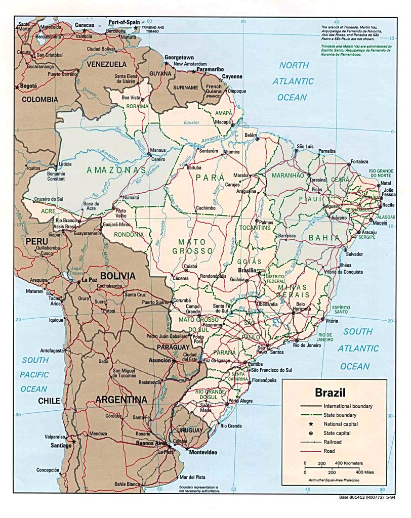
English: There were five states which were heavily affected by the 2009 Maranhão, Ceará, Bahia, Amazonas, and Piauí. This is not the actual flooding, just highlighting the states which have been affected greatest according to the latest news soureces on May 10 2009.
Highlighting a map which is in the public domain, which has been previously modified to create File:Brazil political map (pt).gif as well. This File:Brazil political map (pt).gif had previously modified this public domain image File:Brazil pol94.jpg as well. |
| Source | Own work |
| Author | SriMesh |
| Other versions | File:Brazil pol94.jpg |
.gif)
.gif)
Licensing
| I, the copyright holder of this work, release this work into the public domain. This applies worldwide. In some countries this may not be legally possible; if so: I grant anyone the right to use this work for any purpose, without any conditions, unless such conditions are required by law. |
File history
Click on a date/time to view the file as it appeared at that time.
| Date/Time | Thumbnail | Dimensions | User | Comment | |
|---|---|---|---|---|---|
| current | 04:28, 12 May 2009 | | 1,397 × 1,761 (2.46 MB) | SriMesh | {{Information |Description={{en|1=There were five states which were heavily affected by the 2009 Maranhão , Ceará, Bahia, Amazonas, and Piauí . This is |
File usage
The following page uses this file:
Global file usage
The following other wikis use this file:
- Usage on de.wikinews.org