File:Greater Manchester UK locator map 2010.svg
Jump to navigation
Jump to search

Size of this PNG preview of this SVG file: 494 × 600 pixels. Other resolutions: 198 × 240 pixels | 395 × 480 pixels | 633 × 768 pixels | 843 × 1,024 pixels | 1,687 × 2,048 pixels | 1,108 × 1,345 pixels.
Original file (SVG file, nominally 1,108 × 1,345 pixels, file size: 302 KB)
| This free media file is from Wikimedia Commons. Its description page is included below. |
Summary
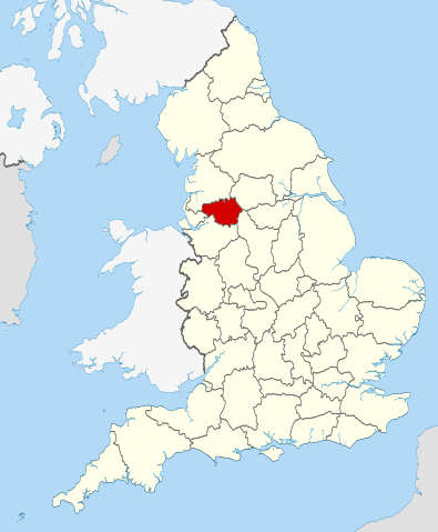
| Description | Location of the ceremonial county of Greater Manchester within England. |
| Date | |
| Source |
National Geospatial-Intelligence Agency
|
| Author | Nilfanion |
Licensing
I, the copyright holder of this work, hereby publish it under the following licenses:
This file is licensed under the Creative Commons Attribution-Share Alike 3.0 Unported license.
- You are free:
- to share – to copy, distribute and transmit the work
- to remix – to adapt the work
- Under the following conditions:
- attribution – You must give appropriate credit, provide a link to the license, and indicate if changes were made. You may do so in any reasonable manner, but not in any way that suggests the licensor endorses you or your use.
- share alike – If you remix, transform, or build upon the material, you must distribute your contributions under the same or compatible license as the original.

|
Permission is granted to copy, distribute and/or modify this document under the terms of the GNU Free Documentation License, Version 1.2 or any later version published by the Free Software Foundation; with no Invariant Sections, no Front-Cover Texts, and no Back-Cover Texts. A copy of the license is included in the section entitled GNU Free Documentation License. |
You may select the license of your choice.

|
This is one of the images forming part of the Valued image set: Locator maps of the Ceremonial counties of England on Wikimedia Commons. The image set has been assessed under the valued image set criteria and is considered the most valued set on Commons within the scope:
Locator maps of the Ceremonial counties of England
You can see its nomination at Commons:Valued image candidates/Locator maps of English ceremonial counties. |
File history
Click on a date/time to view the file as it appeared at that time.
| Date/Time | Thumbnail | Dimensions | User | Comment | |
|---|---|---|---|---|---|
| current | 22:37, 23 November 2010 | | 1,108 × 1,345 (302 KB) | Nilfanion | == Summary == {{Information |Description=Location of the ceremonial county of Greater Manchester within England. |Source=Ordnance Survey [https://www.ordnancesurvey.co.uk/opendatadownload/products.html OpenDa |
File usage
No pages on the English Wikinews link to this file. Pages on other Wikimedia projects are not listed here.
Global file usage
The following other wikis use this file:
- Usage on af.wikipedia.org
- Usage on an.wikipedia.org
- Usage on ar.wikipedia.org
- Usage on arz.wikipedia.org
- Usage on ast.wikipedia.org
- Usage on be-tarask.wikipedia.org
- Usage on be.wikipedia.org
- Usage on bg.wikipedia.org
- Usage on bn.wikipedia.org
- Usage on br.wikipedia.org
- Usage on ca.wikipedia.org
- Usage on ceb.wikipedia.org
- Usage on cs.wikipedia.org
- Usage on en.wikipedia.org
- Greater Manchester
- Egerton, Greater Manchester
- Etherow Country Park
- River Bollin
- River Croal
- Parrs Wood
- Transport for Greater Manchester
- Friezland
- Strinesdale Reservoir
- Moorside, Greater Manchester
- Heald Green
- Bryn, Greater Manchester
- Three Sisters Recreation Area
- Peel Green
- Audenshaw Reservoirs
- Offerton, Greater Manchester
- Gorton North
- Carrbrook
- Ancoats and Clayton
- Adswood
- Turf Lea
- Hawk Green
- Template:GreaterManchester-geo-stub
- Bosden Farm
- Talk:Greater Manchester Passenger Transport Executive
- Makerfield
- Exchange Square, Manchester
- Old Moat
- Worthington, Greater Manchester
- Prestolee
- Copley, Greater Manchester
- Benchill
- Standish-with-Langtree
- Bucklow Rural District
- Bury Rural District
View more global usage of this file.