File:Ke-map.png
Jump to navigation
Jump to search
No higher resolution available.
Ke-map.png (325 × 349 pixels, file size: 16 KB, MIME type: image/png)
| This free media file is from Wikimedia Commons. Its description page is included below. |
Summary
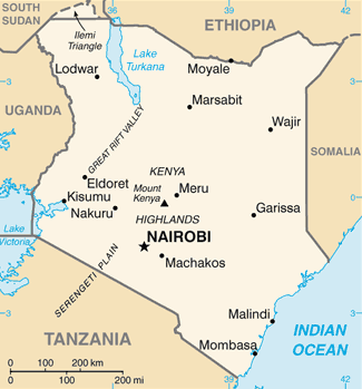
| Description | Kenya map from CIA World Factbook, converted from original GIF format (July 2011 version showing South Sudan) |
| Date | |
| Source |
CIA World Factbook |
| Author | United States Central Intelligence Agency |
| Other versions |
|
.png)
Licensing
This image is in the public domain because it contains materials that originally came from the United States Central Intelligence Agency's World Factbook.
|
 |
File history
Click on a date/time to view the file as it appeared at that time.
| Date/Time | Thumbnail | Dimensions | User | Comment | |
|---|---|---|---|---|---|
| current | 04:58, 12 February 2022 | | 325 × 349 (16 KB) | Lojwe | Cropped 1 % horizontally, 1 % vertically using CropTool with precise mode. |
| 00:04, 13 July 2011 |  | 329 × 354 (47 KB) | Béka~commonswiki | new version with South Sudan, from CIA | |
| 20:12, 5 March 2005 |  | 330 × 353 (10 KB) | Alfio | CIA map of Kenya |
File usage
The following 2 pages use this file:
Global file usage
The following other wikis use this file:
- Usage on bn.wikipedia.org
- Usage on ca.wikipedia.org
- Usage on da.wikipedia.org
- Usage on de.wikipedia.org
- Usage on de.wikinews.org
- Usage on dsb.wikipedia.org
- Usage on en.wikipedia.org
- Usage on eo.wikipedia.org
- Usage on es.wikipedia.org
- Usage on fa.wikipedia.org
- Usage on fi.wikipedia.org
- Usage on fo.wikipedia.org
- Usage on fr.wikipedia.org
- Usage on gom.wikipedia.org
- Usage on he.wikipedia.org
- Usage on hi.wikipedia.org
- Usage on hu.wikipedia.org
- Usage on ilo.wikipedia.org
- Usage on io.wikipedia.org
- Usage on it.wikipedia.org
- Usage on it.wikinews.org
- Usage on ja.wikipedia.org
- Usage on ka.wikipedia.org
- Usage on kn.wikipedia.org
- Usage on ml.wikipedia.org
- Usage on mr.wikipedia.org
- Usage on nn.wikipedia.org
- Usage on no.wikipedia.org
View more global usage of this file.