File:Map of USA HI.svg
Jump to navigation
Jump to search

Size of this PNG preview of this SVG file: 286 × 186 pixels. Other resolutions: 320 × 208 pixels | 640 × 416 pixels | 1,024 × 666 pixels | 1,280 × 832 pixels | 2,560 × 1,665 pixels.
Original file (SVG file, nominally 286 × 186 pixels, file size: 167 KB)
| This free media file is from Wikimedia Commons. Its description page is included below. |
Clickable version
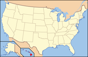
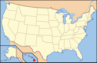
| Description | Map of USA with Hawaii highlighted | ||||||||
| Date | see file history below. | ||||||||
| Source | own work by uploader, based on Image:Map of USA without state names.svg | ||||||||
| Author |
This version: uploader Base versions this one is derived from: originally created by en:User:Wapcaplet |
||||||||
| Permission (Reusing this file) |
This file is licensed under the Creative Commons Attribution 2.0 Generic license.
|
||||||||
| Other versions | image:Map of USA with state names.svg |

| Annotations | This image is annotated: View the annotations at Commons |
File history
Click on a date/time to view the file as it appeared at that time.
| Date/Time | Thumbnail | Dimensions | User | Comment | |
|---|---|---|---|---|---|
| current | 19:27, 22 February 2019 | | 286 × 186 (167 KB) | Guycn2 | All other similar maps have a border (e.g. File:Map of USA AK.svg, File:Map of USA FL.svg, etc.) |
| 18:49, 20 August 2010 |  | 286 × 186 (168 KB) | Techman224 | Removed Border | |
| 06:23, 9 June 2006 |  | 286 × 186 (167 KB) | Huebi~commonswiki | {{Information| |Description=Map of USA with Hawaii highlighted |other_versions=image:Map of USA with state names.svg }} Category:Maps of the United States Category:Maps of Hawaii Category:SVG maps {{GFDL-en}}{{cc-by-2.0}}{{cc-by-sa-1.0} |
File usage
No pages on the English Wikinews link to this file. Pages on other Wikimedia projects are not listed here.
Global file usage
The following other wikis use this file:
- Usage on af.wikipedia.org
- Usage on an.wikipedia.org
- Usage on ar.wikipedia.org
- Usage on ay.wikipedia.org
- Usage on be-tarask.wikipedia.org
- Usage on bg.wikipedia.org
- Usage on bi.wikipedia.org
- Usage on bpy.wikipedia.org
- Usage on ca.wikipedia.org
- Usage on cs.wikipedia.org
- Usage on da.wikipedia.org
- Usage on de.wikipedia.org
- Benutzer:Wolfgang1018/Wikipedia-Quiz
- Kategorie:Hawaii
- Vorwahlergebnisse der Präsidentschaftswahl in den Vereinigten Staaten 2008
- Flaggen und Siegel der US-Bundesstaaten
- Vorwahlergebnisse der Präsidentschaftswahl in den Vereinigten Staaten 2016
- Vorwahlergebnisse der Präsidentschaftswahl in den Vereinigten Staaten 2020
- Vorwahlergebnisse der Präsidentschaftswahl in den Vereinigten Staaten 2024
- Benutzer:Sarkana/Vorwahlergebnisse 2024
- Usage on el.wikipedia.org
- Usage on en.wikipedia.org
- List of state and territory name etymologies of the United States
- Category:Hawaii
- Hawaii Department of Public Safety
- Template talk:Infobox U.S. county/Archive 1
- User:Sesh/Democratic Party Presidential Primaries 2008
- User talk:The Obento Musubi/US State
- LGBT rights in Hawaii
- Category:Images of Hawaii
- Equality Hawaii
- Hawaii Department of Law Enforcement
- Hawaii Department of Corrections and Rehabilitation
- Usage on en.wikibooks.org
- Usage on es.wikinews.org
- Usage on fa.wikipedia.org
- Usage on frr.wikipedia.org
- Usage on fr.wikipedia.org
- Usage on he.wikipedia.org
View more global usage of this file.