File:Map of USA MA.svg
Jump to navigation
Jump to search

Size of this PNG preview of this SVG file: 286 × 186 pixels. Other resolutions: 320 × 208 pixels | 640 × 416 pixels | 1,024 × 666 pixels | 1,280 × 832 pixels | 2,560 × 1,665 pixels.
Original file (SVG file, nominally 286 × 186 pixels, file size: 167 KB)
| This free media file is from Wikimedia Commons. Its description page is included below. |
Clickable version
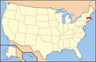
| Description | Map of USA with Massachusetts highlighted | ||||||||
| Date | see file history below. | ||||||||
| Source | own work by uploader, based on Image:Map of USA without state names.svg | ||||||||
| Author |
This version: uploader Base versions this one is derived from: originally created by en:User:Wapcaplet |
||||||||
| Permission (Reusing this file) |
This file is licensed under the Creative Commons Attribution 2.0 Generic license.
|
||||||||
| Other versions | image:Map of USA with state names.svg |

File history
Click on a date/time to view the file as it appeared at that time.
| Date/Time | Thumbnail | Dimensions | User | Comment | |
|---|---|---|---|---|---|
| current | 07:00, 9 June 2006 | | 286 × 186 (167 KB) | Huebi~commonswiki | {{Information| |Description=Map of USA with Massachusettes highlighted |other_versions=image:Map of USA with state names.svg }} Category:Maps of the United States Category:Maps of Massachusettes Category:SVG maps {{GFDL-en}}{{cc-by-2.0} |
File usage
The following page uses this file:
Global file usage
The following other wikis use this file:
- Usage on af.wikipedia.org
- Usage on ang.wikipedia.org
- Usage on arc.wikipedia.org
- Usage on ay.wikipedia.org
- Usage on az.wiktionary.org
- Usage on ba.wikipedia.org
- Usage on bcl.wikipedia.org
- Usage on be-tarask.wikipedia.org
- Usage on bi.wikipedia.org
- Usage on bpy.wikipedia.org
- Usage on bxr.wikipedia.org
- Usage on ca.wikipedia.org
- Usage on ce.wikipedia.org
- Usage on co.wikipedia.org
- Usage on cs.wikipedia.org
- Administrativní dělení Spojených států amerických
- Cambridge (Massachusetts)
- Winchendon
- Uxbridge (Massachusetts)
- Provincetown
- Williamstown (Massachusetts)
- Leicester (Massachusetts)
- South Deerfield
- Sterling (Massachusetts)
- Salem (Massachusetts)
- Beverly (Massachusetts)
- Peabody (Massachusetts)
- Concord (Massachusetts)
- Foxborough
- Amherst
- Webster (Massachusetts)
- Fitchburg (Massachusetts)
- Oxford (Massachusetts)
- Shrewsbury (Massachusetts)
- Berlin (Massachusetts)
- Usage on cu.wikipedia.org
- Usage on cv.wikipedia.org
- Usage on da.wikipedia.org
View more global usage of this file.