File:CHN orthographic.svg
Jump to navigation
Jump to search

Size of this PNG preview of this SVG file: 550 × 550 pixels. Other resolutions: 240 × 240 pixels | 480 × 480 pixels | 768 × 768 pixels | 1,024 × 1,024 pixels | 2,048 × 2,048 pixels.
Original file (SVG file, nominally 550 × 550 pixels, file size: 1.46 MB)
| This free media file is from Wikimedia Commons. Its description page is included below. |
Summary
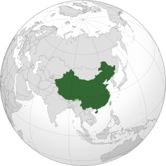
| Description | China orthographic map |
| Date |
|
| Source |
Own work |
| Author |
Addicted04 |
.svg)
.svg)
.svg)
.svg)
.svg)
.svg)
.svg)
.svg)
.svg)
.svg)
.svg)
.svg)
.svg)
.svg)
.svg)
.svg)
.svg)
.svg)
.svg)
.svg)
.svg)
.svg)
.svg)
.svg)
.svg)
.svg)
.svg)
.svg)
.svg)
.svg)
.svg)
.svg)
.svg)
.svg)
.svg)
.svg)
.svg)
.svg)
.svg)
.svg)
.svg)
.svg)
.svg)
.svg)
.svg)
.svg)
.svg)
.svg)
.svg)
.svg)
.svg)
.svg)
.svg)
.svg)
.svg)
.svg)
.svg)
.svg)
.svg)
.svg)
.svg)
.svg)
.svg)
.svg)
.svg)
.svg)
.svg)
.svg)
.svg)
.svg)
.svg)
.svg)
.svg)
.svg)

.svg)

.svg)

.svg)
.svg)
.svg)
.svg)
.svg)
.svg)
.svg)


.svg)
.svg)
.svg)
.svg)
.svg)
.svg)
.svg)

.svg)
.svg)
.svg)
.svg)
.svg)
.svg)
.svg)
.svg)
.svg)

.svg)
.svg)
.svg)
.svg)
.svg)
.svg)
.svg)
_without_national_boundaries.svg)
.svg)
.svg)
.svg)
.svg)
.svg)
.svg)

.svg)
.svg)
.png)
.svg)
.svg)
.svg)
.svg)

.svg)
.svg)
.svg)
.svg)
.svg)
.svg)
.svg)
.svg)
.svg)
.svg)
.svg)

.svg)
.svg)
.svg)
.svg)
.svg)
.svg)
.svg)
.svg)
.svg)

.svg)
.svg)

.svg)
.svg)
.svg)
.svg)
.svg)
.svg)
.svg)
.svg)
.svg)
.svg)
.svg)
.svg)
.svg)
.svg)
.svg)
.svg)
.svg)
.svg)
.svg)
.svg)
.svg)
.svg)
.svg)
.svg)
.svg)
.svg)
.svg)
_-_Crimea_disputed.svg)
.svg)
.svg)
.svg)
.svg)
.svg)
.svg)
.svg)
.svg)
.svg)
.svg)
.svg)
_political.svg)
.svg)
.svg)
.svg)
.svg)
_-_Crimea_disputed_-_no_borders.svg)
.svg)
.svg)
.svg)
.svg)
.svg)
.svg)
.svg)
.svg)
.svg)
.svg)
.svg)

.svg)
.svg)
.svg)

.png)
.svg)
.svg)
.svg)
.svg)
.svg)
.svg)
.svg)
.svg)
.svg)
.svg)
.svg)
.svg)
.svg)
.svg)
.svg)
.svg)
.svg)
.svg)
.svg)
.svg)
.svg)
.svg)
.svg)
.svg)
.svg)
.svg)
.svg)
.svg)
.svg)
.svg)
.svg)
.svg)
.svg)
.svg)
.png)
.svg)
.svg)
.svg)
_(orthographic_projection).png)
| Orthographic projections maps created by Ssolbergj |
|---|
| Orthographic projections maps created by Ssolbergj: |
.svg)
.svg)
| Annotations | This image is annotated: View the annotations at Commons |
Licensing
I, the copyright holder of this work, hereby publish it under the following license:
This file is licensed under the Creative Commons Attribution-Share Alike 3.0 Unported license.
- You are free:
- to share – to copy, distribute and transmit the work
- to remix – to adapt the work
- Under the following conditions:
- attribution – You must give appropriate credit, provide a link to the license, and indicate if changes were made. You may do so in any reasonable manner, but not in any way that suggests the licensor endorses you or your use.
- share alike – If you remix, transform, or build upon the material, you must distribute your contributions under the same or compatible license as the original.

|
WARNING! According to Chinese Law, producing, selling and advertising maps or other items, both in electronic and print versions, that do not conform to the territorial claims of the Chinese government is prohibited. |
File history
Click on a date/time to view the file as it appeared at that time.
| Date/Time | Thumbnail | Dimensions | User | Comment | |
|---|---|---|---|---|---|
| current | 06:04, 11 February 2020 | | 550 × 550 (1.46 MB) | 芄蘭 | Reverted to version as of 14:28, 31 July 2019 (UTC) |
| 13:02, 10 February 2020 |  | 720 × 722 (334 KB) | Abhishek65628 | Reverted to version as of 15:44, 25 July 2019 (UTC) | |
| 14:28, 31 July 2019 |  | 550 × 550 (1.46 MB) | The Account 1 | Reverted to version as of 22:59, 22 October 2011 (UTC) China still claims Arunachal Pradesh | |
| 15:44, 25 July 2019 |  | 720 × 722 (334 KB) | Lakshmisreekanth | Updated image | |
| 22:59, 22 October 2011 |  | 550 × 550 (1.46 MB) | Addicted04 | claimed color | |
| 22:03, 22 October 2011 |  | 550 × 550 (1.46 MB) | Addicted04 |
File usage
More than 100 pages use this file. The following list shows the first 100 pages that use this file only. A full list is available.
- 'Statues of Democracy' removed in Hong Kong
- 'Very serious': Chinese government releases corruption report
- 20 dead, seventeen trapped after Chinese coal mine explosion
- 21 infants found dead in Chinese river
- 22 killed as heavy rain hits Panzhihua, China
- 25 dead after fire in Chinese coal mine
- 25 killed and 33 injured as explosion rips through Chinese karaoke bar
- 26 killed after mine accident in China
- 6.9 magnitude earthquake hits western China
- Anti-China protesters clash with police in Tibet
- At least 21 dead after coal mine explosion in Chinese mine
- At least 32 dead after snowstorms in China
- At least 73 dead after blast in Chinese coal mine
- Blast kills seven in China
- British national Akmal Shaikh executed in China
- Briton faces execution in China
- Buildings destroyed to slow flooding in China lake
- China's consumer prices rise to a three-year high in June as food prices soar 14.4 percent
- China's military spending increases by 7.5%
- China's winter weather threatens food supplies
- China-EU financial relations are growing
- China: 'the Dalai Lama is scheming to take the Beijing Olympics hostage'
- China: Heavy flooding displaces over a million, kills dozens
- China Eastern Airlines to purchase twenty new Airbus A320 jets
- China and Indonesia hail deal of Copenhagen summit
- China and Russia sign trade deals worth US$3.5 billion
- China bans free plastic bags
- China executes more people than rest of world combined, according to report
- China executes nine for ethnic riots
- China launches major cleanup operation after oil spill
- China overtakes Germany as world's biggest exporter
- China plans to ban smoking in indoor public places
- China promises cut in carbon dioxide emissions
- China sends its first aircraft carrier to sea
- China sentences dissident to eleven years in prison
- China sentences geologist to eight years in prison despite US appeal
- China sentences six more to death over riots
- China to establish protest zones for Olympics
- China to surpass Japan to become second largest economy
- China warns US to avoid trade confrontation
- Chinese court sentences six to death for Xinjiang riots
- Chinese dissident goes on trial for subversion
- Chinese earthquake: Death toll reaches almost 15,000 as 'dangerous' cracks found in dam near city
- Chinese girl who was hit and run by two drivers, ignored by eighteen people, dies
- Chinese hackers call off attack on CNN website
- Chinese human rights activist faces trial
- Chinese police offer 300,000 yuan reward in double bus bombings
- Chinese quake death toll nears 32,500, as a major aftershock occurs and mourning begins
- Chinese stock markets plunge after tax increase
- Death sentences in 2008 Chinese tainted milk scandal
- Death toll from China rainstorm reaches 65
- Death toll from Chinese earthquake passes 2,000
- Derailment in China; at least nineteen dead
- Eleven days later, a survivor pulled from rubble after Chinese earthquake
- Formula One: Jenson Button wins 2010 Chinese Grand Prix
- Foxconn employee commits suicide over missing iPhone in China
- Foxconn under pressure after tenth employee suicide this year
- Gas leak kills six and injures 28 at Chinese fertiliser factory
- Highly contagious Hand, foot and mouth disease killing China's children
- Hong Kong's only railway company modifies regulations
- Hong Kong Democratic Party stirs up universal suffrage reform package controversy
- Hong Kong by-elections start
- Hong Kong chief executive invites opponent to television debate
- Hong Kong teenager murders mother and sister
- Imperial College London geology students fined in China for "illegal map-making"
- Lewis Hamilton wins 2008 Chinese Grand Prix
- Lift accident in Hong Kong skyscraper kills six
- Long March rocket launches first Fengyun-3 weather satellite
- Lower court in China sentences Food and Drug official to death for taking bribes
- Magnitude 6.0 earthquake in China kills three, injures dozens
- Massive flooding in China; over 550 thousand evacuated
- Mine explosion in northeastern China kills at least 42, dozens more trapped
- Modern technology maps new sections of the Great Wall of China
- More than 100 die in riots in Ürümqi, China
- Mourning ceremonies for earthquake begin throughout China
- Murderer of road accident victim sentenced to death
- Nitrite poisoned milk kills three babies, sickens 35 in China
- Not enough names to go around in China, ministry says
- Rescue efforts underway after China earthquake
- School stampede in China kills eight, injures dozens more
- Sebastian Vettel wins wet 2009 Chinese Grand Prix
- Seven killed in Chinese bombing
- Several large explosions reported in Xinjiang, China
- Severe sandstorm strikes Beijing, China
- Sixteen policemen killed in suspected terrorist attack in Xinjiang, China
- Strong 6.5 earthquake strikes China
- Suicidal man pushed off Chinese bridge
- Three firefighters killed in blaze at Chinese plastics factory
- Tiger kills handler in Shanghai zoo
- Train accident in China kills at least 43
- Twentieth anniversary of the Tiananmen Square protests passes in China
- Two trains collide in China killing dozens and injuring hundreds
- Typhoon kills two in southern China
- Typhoon prompts massive evacuations in China
- Windows 7 gets 'early release' in China; software pirates beat Microsoft to the punch
- World’s largest ice 'Father Christmas' built in China
- Xinhua says ship carrying hazardous goods sank in China's Yangtze river
- Zimbabwean cargo plane crashes in Shanghai; three dead
- User:Tamás Kádár~enwikinews/work
- Wikinews:Template messages/Infoboxes/Countries
View more links to this file.
Global file usage
The following other wikis use this file:
- Usage on am.wikipedia.org
- Usage on ar.wikipedia.org
- الصين
- مستخدم:جار الله/قائمة صور مقالات العلاقات الثنائية
- العلاقات الأنغولية الصينية
- العلاقات الصينية الكورية الجنوبية
- العلاقات الصينية الإريترية
- العلاقات الصينية السويسرية
- العلاقات الألمانية الصينية
- العلاقات الصينية الليختنشتانية
- العلاقات الصينية البوليفية
- العلاقات الصينية الموزمبيقية
- العلاقات الصينية البلجيكية
- العلاقات الصينية الإثيوبية
- العلاقات الصينية البيلاروسية
- العلاقات الصينية الطاجيكية
- العلاقات الصينية الروسية منذ عام 1991
- العلاقات الصينية الرومانية
- العلاقات الأرجنتينية الصينية
- العلاقات الصينية الغامبية
- العلاقات الصينية القبرصية
- العلاقات الصينية السيراليونية
- العلاقات الصينية النيبالية
- العلاقات الصينية الليبيرية
- العلاقات التشيكية الصينية
- العلاقات الصينية الميانمارية
- العلاقات الصينية الزيمبابوية
- العلاقات الصينية البالاوية
- العلاقات الصينية المالية
- العلاقات الصينية النيجيرية
- العلاقات الصينية الفانواتية
- العلاقات الصينية الغابونية
- العلاقات الصينية البنمية
- العلاقات الصينية الكوبية
- العلاقات الصينية الجورجية
- العلاقات التونسية الصينية
- العلاقات الصينية الهندية
- العلاقات الصينية الإيطالية
- العلاقات الصينية الناوروية
- العلاقات الأسترالية الصينية
- العلاقات الزامبية الصينية
- العلاقات الصينية الفيجية
- العلاقات الصينية المارشالية
- العلاقات الأذربيجانية الصينية
- العلاقات الصينية الكونغوية
- العلاقات الصينية الدومينيكانية
- العلاقات البرازيلية الصينية
- العلاقات الصينية الغرينادية
- العلاقات الصينية الكازاخستانية
- العلاقات الصينية الكوستاريكية
- العلاقات الصينية الصربية
View more global usage of this file.