File:Canada Ontario location map 2.svg
Jump to navigation
Jump to search

Size of this PNG preview of this SVG file: 526 × 599 pixels. Other resolutions: 211 × 240 pixels | 421 × 480 pixels | 674 × 768 pixels | 899 × 1,024 pixels | 1,798 × 2,048 pixels | 2,032 × 2,314 pixels.
Original file (SVG file, nominally 2,032 × 2,314 pixels, file size: 1.4 MB)
| This free media file is from Wikimedia Commons. Its description page is included below. |
Summary
| Description |
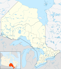
Quadratische Plattkarte, N-S-Streckung 155 %. Geographische Begrenzung der Karte:
Equirectangular projection, N/S stretching 155 %. Geographic limits of the map:
|
| Date | |
| Source |
NordNordWest, using
|
| Author | NordNordWest |
| Permission (Reusing this file) |
I, the copyright holder of this work, hereby publish it under the following license: This file is licensed under the Creative Commons Attribution-Share Alike 3.0 Unported license.
|
| Other versions |
|


File history
Click on a date/time to view the file as it appeared at that time.
| Date/Time | Thumbnail | Dimensions | User | Comment | |
|---|---|---|---|---|---|
| current | 21:32, 22 September 2009 | | 2,032 × 2,314 (1.4 MB) | Michiel1972 | {{int:filedesc}} {{Information |Description= {{de|Positionskarte von Ontario, Kanada}} Quadratische Plattkarte, N-S-Streckung 155 %. Geographische Begrenzung der Karte: * N: 57.1° N * S: 41.3° N * W: 95.5° W * O: 74.0° W |
File usage
No pages on the English Wikinews link to this file. Pages on other Wikimedia projects are not listed here.
Global file usage
The following other wikis use this file:
- Usage on af.wikipedia.org
- Usage on als.wikipedia.org
- Usage on ar.wikipedia.org
- Usage on ast.wikipedia.org
- Usage on azb.wikipedia.org
- Usage on ba.wikipedia.org
- Usage on bg.wikipedia.org
- Usage on bn.wikipedia.org
- Usage on ceb.wikipedia.org
- Usage on cs.wikipedia.org
- Usage on da.wikipedia.org
- Usage on en.wikipedia.org
View more global usage of this file.