File:Central America (orthographic projection).svg
Jump to navigation
Jump to search

Size of this PNG preview of this SVG file: 550 × 550 pixels. Other resolutions: 240 × 240 pixels | 480 × 480 pixels | 768 × 768 pixels | 1,024 × 1,024 pixels | 2,048 × 2,048 pixels.
Original file (SVG file, nominally 550 × 550 pixels, file size: 354 KB)
| This free media file is from Wikimedia Commons. Its description page is included below. |
Summary
| Description |
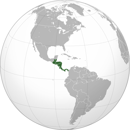
English: Central America (orthographic projection) with colonial borders |
||||
| Date | |||||
| Source |
Own work (Original text: Own work,)
|
||||
| Author | Heraldry | ||||
| Permission (Reusing this file) |
|
||||
| Other versions |
.svg) |
||||
| SVG development |

.svg)
.svg)
.svg)
.svg)
.svg)
.svg)
.svg)
.svg)
.svg)
.svg)
.svg)
.svg)
.svg)
.svg)
.svg)
.svg)
.svg)
.svg)
.svg)
.svg)
.svg)
.svg)
.svg)
.svg)
.svg)
.svg)
.svg)
.svg)
.svg)
.svg)
.svg)
.svg)
.svg)
.svg)
.svg)
.svg)
.svg)
.svg)
.svg)
.svg)
.svg)
.svg)
.svg)
.svg)
.svg)
.svg)
.svg)
.svg)
.svg)
.svg)
.svg)
.svg)
.svg)
.svg)
.svg)
.svg)
.svg)
.svg)
.svg)
.svg)
.svg)
.svg)
.svg)
.svg)
.svg)
.svg)
.svg)
.svg)
.svg)
.svg)
.svg)
.svg)
.svg)

.svg)

.svg)

.svg)
.svg)
.svg)
.svg)
.svg)
.svg)
.svg)


.svg)
.svg)
.svg)
.svg)
.svg)
.svg)
.svg)

.svg)
.svg)
.svg)
.svg)
.svg)
.svg)
.svg)
.svg)
.svg)

.svg)
.svg)
.svg)
.svg)
.svg)
.svg)
.svg)
_without_national_boundaries.svg)
.svg)
.svg)
.svg)
.svg)
.svg)
.svg)

.svg)
.svg)
.png)
.svg)
.svg)
.svg)
.svg)

.svg)
.svg)
.svg)
.svg)
.svg)
.svg)
.svg)
.svg)
.svg)
.svg)
.svg)

.svg)
.svg)
.svg)
.svg)
.svg)
.svg)
.svg)
.svg)
.svg)

.svg)
.svg)

.svg)
.svg)
.svg)
.svg)
.svg)
.svg)
.svg)
.svg)
.svg)
.svg)
.svg)
.svg)
.svg)
.svg)
.svg)
.svg)
.svg)
.svg)
.svg)
.svg)
.svg)
.svg)
.svg)
.svg)
.svg)
.svg)
.svg)
_-_Crimea_disputed.svg)
.svg)
.svg)
.svg)
.svg)
.svg)
.svg)
.svg)
.svg)
.svg)
.svg)
.svg)
_political.svg)
.svg)
.svg)
.svg)
.svg)
_-_Crimea_disputed_-_no_borders.svg)
.svg)
.svg)
.svg)
.svg)
.svg)
.svg)
.svg)
.svg)
.svg)
.svg)
.svg)

.svg)
.svg)
.svg)

.png)
.svg)
.svg)
.svg)
.svg)
.svg)
.svg)
.svg)
.svg)
.svg)
.svg)
.svg)
.svg)
.svg)
.svg)
.svg)
.svg)
.svg)
.svg)
.svg)
.svg)
.svg)
.svg)
.svg)
.svg)
.svg)
.svg)
.svg)
.svg)
.svg)
.svg)
.svg)
.svg)
.svg)
.svg)
.png)
.svg)
.svg)
.svg)
_(orthographic_projection).png)
.svg)
.svg)
.svg)
.svg)
.svg)
Licensing
I, the copyright holder of this work, hereby publish it under the following license:

|
Permission is granted to copy, distribute and/or modify this document under the terms of the GNU Free Documentation License, Version 1.2 or any later version published by the Free Software Foundation; with no Invariant Sections, no Front-Cover Texts, and no Back-Cover Texts. A copy of the license is included in the section entitled GNU Free Documentation License. |
| This file is licensed under the Creative Commons Attribution-Share Alike 3.0 Unported license. | ||
| ||
| This licensing tag was added to this file as part of the GFDL licensing update. |
File history
Click on a date/time to view the file as it appeared at that time.
.svg&dir=prev)
.svg&offset=20090710081847)
.svg&offset=&limit=20)
.svg&offset=&limit=50)
.svg&offset=&limit=100)
.svg&offset=&limit=250)
.svg&offset=&limit=500)
| Date/Time | Thumbnail | Dimensions | User | Comment | |
|---|---|---|---|---|---|
| current | 02:01, 29 June 2023 | | 550 × 550 (354 KB) | Avaflyne | Reverted to version as of 05:29, 26 June 2023 (UTC) |
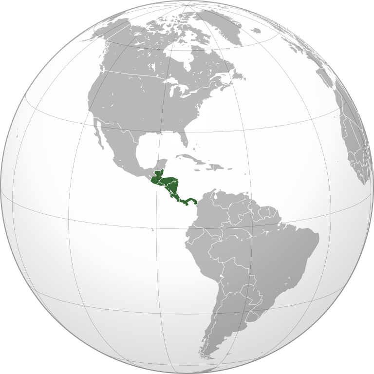
| 14:15, 26 June 2023 |  | 2,048 × 2,048 (391 KB) | HelpfulHens | Mexico is part of Central America according the the United Nations | |
| 05:29, 26 June 2023 |  | 550 × 550 (354 KB) | Treetoes023 | Reverted to version as of 15:04, 25 November 2009 (UTC) | |
| 20:31, 25 June 2023 |  | 2,048 × 2,048 (391 KB) | HelpfulHens | Removed Colombia and Venezuela | |
| 13:11, 13 March 2023 |  | 550 × 550 (354 KB) | LR0725 | Reverted to version as of 15:04, 25 November 2009 (UTC) | |
| 22:26, 9 March 2023 |  | 600 × 600 (519 KB) | TBAG654321 | Added Mexico | |
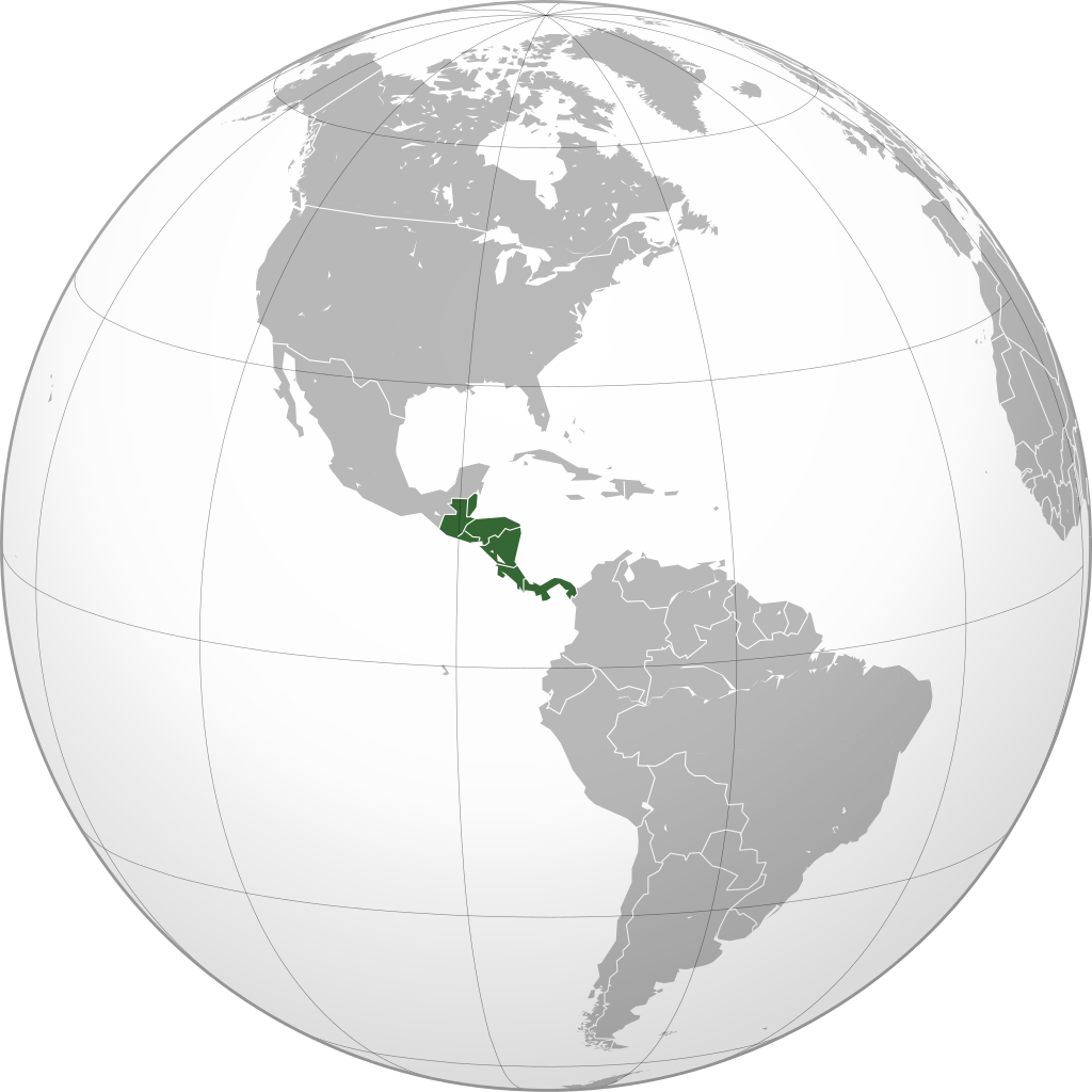
| 15:04, 25 November 2009 |  | 550 × 550 (354 KB) | Keepscases | borders should be more intense | |
| 16:41, 7 September 2009 |  | 550 × 550 (354 KB) | TownDown | sized according | |
| 08:32, 10 July 2009 |  | 541 × 541 (353 KB) | TownDown | details | |
| 08:18, 10 July 2009 |  | 541 × 541 (354 KB) | TownDown | focused |
File usage
The following page uses this file:
Global file usage
The following other wikis use this file:
- Usage on af.wikipedia.org
- Usage on am.wikipedia.org
- Usage on ar.wikipedia.org
- Usage on ar.wikinews.org
- Usage on be-tarask.wikipedia.org
- Usage on be.wikipedia.org
- Usage on bg.wikipedia.org
- Usage on bi.wikipedia.org
- Usage on bn.wikipedia.org
- Usage on br.wikipedia.org
- Usage on ceb.wikipedia.org
- Usage on co.wikimedia.org
- Usage on cs.wikipedia.org
- Usage on en.wikipedia.org
- Talk:Central America
- Wikipedia:Userboxes/Location
- Wikipedia:Userboxes/Location/Americas
- User:UdovdM
- San Sombrèro
- User:Buaidh
- Wikipedia:WikiProject Central America
- Template:User WikiProject Central America
- Category:Mammals of Central America
- Category:Birds of Central America
- Template:User WP El Salvador
- Wikipedia:Userboxes/Travel
- Category:WikiProject Central America participants
- Category:Jews and Judaism in Central America
- User:Buaidh/Test4
- Template:User interest Belize
- Template:User interest Belize/doc
- Template:User interest Costa Rica
- Template:User interest Costa Rica/doc
- Template:User interest El Salvador
- Template:User interest El Salvador/doc
- Template:User interest Guatemala
- Template:User interest Guatemala/doc
- Template:User interest Honduras
- Template:User interest Honduras/doc
- Template:User interest Nicaragua
View more global usage of this file.
.svg)
.svg)