
File:Daytona International Speedway.svg

Size of this PNG preview of this SVG file: 800 × 428 pixels. Other resolutions: 320 × 171 pixels | 640 × 343 pixels | 1,024 × 548 pixels | 1,280 × 685 pixels | 2,560 × 1,371 pixels | 1,255 × 672 pixels.
Original file (SVG file, nominally 1,255 × 672 pixels, file size: 34 KB)
| This free media file is from Wikimedia Commons. Its description page is included below. |
Summary
| Description |
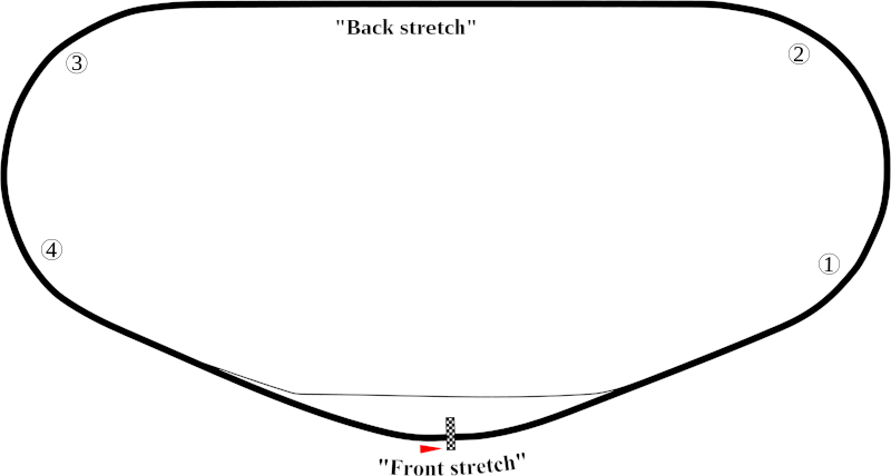
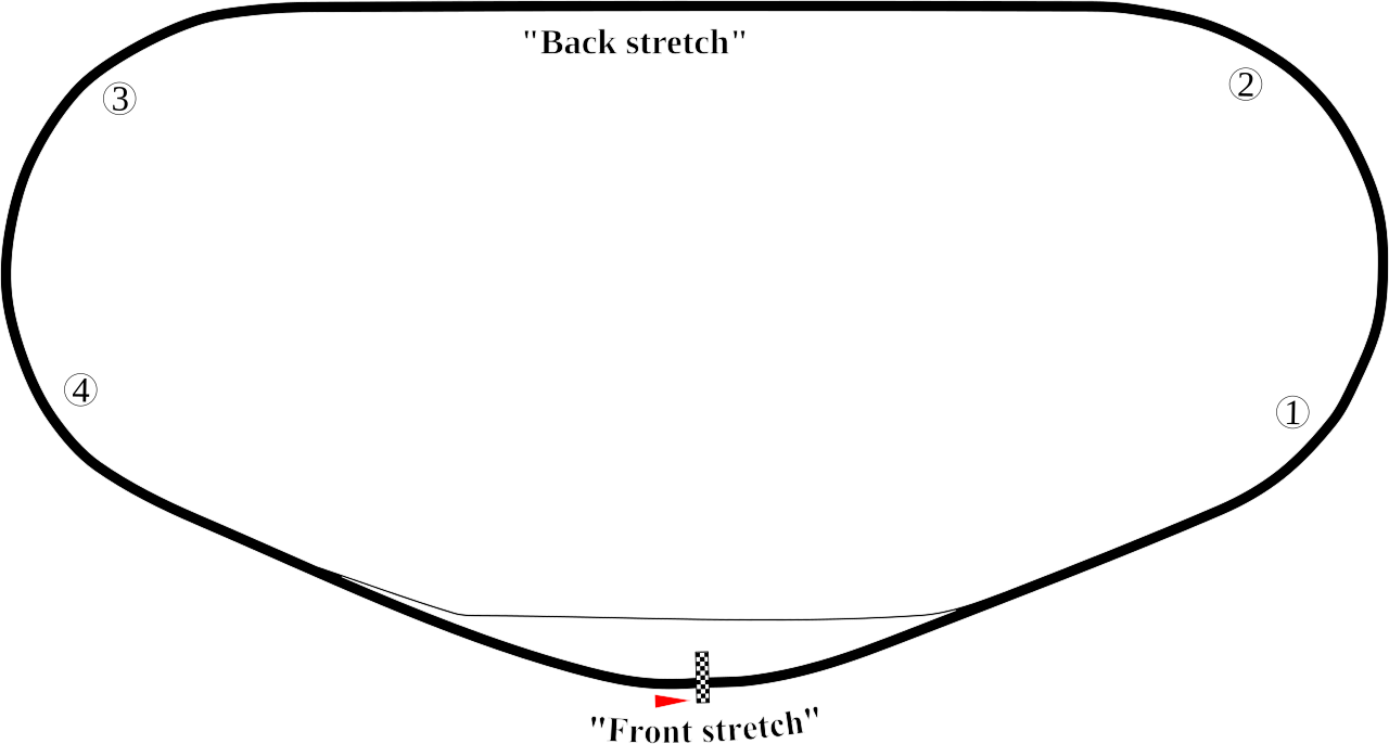
English: Track map of Daytona International Speedway showing mainly the speedway. |
| Date | 7-8-2008 |
| Source | Own work |
| Author | Will Pittenger |
| Other versions |
|


| Camera location | | View this and other nearby images on: OpenStreetMap |
|---|
Licensing
| I, the copyright holder of this work, release this work into the public domain. This applies worldwide. In some countries this may not be legally possible; if so: I grant anyone the right to use this work for any purpose, without any conditions, unless such conditions are required by law. |
File history
Click on a date/time to view the file as it appeared at that time.
| Date/Time | Thumbnail | Dimensions | User | Comment | |
|---|---|---|---|---|---|
| current | 10:30, 8 July 2008 | | 1,255 × 672 (34 KB) | Will Pittenger | This version gets around the Mediawiki bug that hides text on path objects by converting them to ordinary objects. If you need to edit the text in those objects, please use the previous version. They are the same in all other aspects. |
| 10:16, 8 July 2008 |  | 1,255 × 672 (18 KB) | Will Pittenger | {{Information |Description={{en|1=Track map of w:Daytona International Speedway showing mainly the speedway.}} |Source=Own work by uploader |Author=Will Pittenger |Date=7-8-2008 |Permission= |other_versions=[[Image:Daytona Int |
File usage
The following page uses this file:
Global file usage
The following other wikis use this file:
- Usage on ast.wikipedia.org
- Usage on de.wikipedia.org
- Usage on en.wikipedia.org
- Daytona International Speedway
- Bluegreen Vacations Duel
- Tri-oval
- Fresh From Florida 250
- Daytona 300
- 1990 Daytona 500
- Wawa 250
- 2000 Daytona 500
- 1987 Daytona 500
- 1991 Daytona 500
- 1992 Daytona 500
- 1993 Daytona 500
- 2007 Pepsi 400
- Hard Rock Bet 200
- 1959 Daytona 500
- List of auto racing tracks in the United States
- 1986 Daytona 500
- 1989 Daytona 500
- 1988 Daytona 500
- 2009 Budweiser Shootout
- List of Daytona 500 pole position winners
- 2010 Daytona 500
- 2009 Coke Zero 400
- List of NASCAR fatalities
- 1980 Firecracker 400
- 2011 Daytona 500
- 2011 Budweiser Shootout
- 2011 Gatorade Duels
- 1986 Firecracker 400
- 2011 Coke Zero 400
- 2012 Daytona 500
- 2012 Budweiser Shootout
- 2012 Gatorade Duels
- 1999 Pepsi 400
- 1998 Pepsi 400
- 2012 Coke Zero 400
- 2013 Sprint Unlimited
- 2013 Daytona 500
- 2004 Pepsi 400
- 2000 Daytona 250
- 2013 Budweiser Duels
- 2013 DRIVE4COPD 300
- 2013 Coke Zero 400
View more global usage of this file.