File:Guatemala (orthographic projection).svg
Jump to navigation
Jump to search

Size of this PNG preview of this SVG file: 550 × 550 pixels. Other resolutions: 240 × 240 pixels | 480 × 480 pixels | 768 × 768 pixels | 1,024 × 1,024 pixels | 2,048 × 2,048 pixels.
Original file (SVG file, nominally 550 × 550 pixels, file size: 1,019 KB)
| This free media file is from Wikimedia Commons. Its description page is included below. |
.svg)
Gwatamala
Summary
| Description |
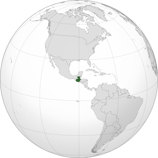
English: Orthographic map of Guatemala centered at 15° N, 90° W.
Official territory.
Claimed territories. Русский: Ортографическая карта Гватемалы с центром в 15° N, 90° W.
Официальная территория.
Заявляемые территории. |
| Date | |
| Source |
Own work with Natural Earth Data This W3C-unspecified vector image was created with Inkscape . |
| Author | Addicted04 |
Licensing
I, the copyright holder of this work, hereby publish it under the following license:
This file is licensed under the Creative Commons Attribution-Share Alike 3.0 Unported license.
- You are free:
- to share – to copy, distribute and transmit the work
- to remix – to adapt the work
- Under the following conditions:
- attribution – You must give appropriate credit, provide a link to the license, and indicate if changes were made. You may do so in any reasonable manner, but not in any way that suggests the licensor endorses you or your use.
- share alike – If you remix, transform, or build upon the material, you must distribute your contributions under the same or compatible license as the original.
File history
Click on a date/time to view the file as it appeared at that time.
| Date/Time | Thumbnail | Dimensions | User | Comment | |
|---|---|---|---|---|---|
| current | 20:04, 12 July 2012 | | 550 × 550 (1,019 KB) | Addicted04 |
File usage
The following 21 pages use this file:
- 'Brakes failed': fourteen killed in Guatemala bus crash
- Assassinated lawyer accuses Guatemalan president from beyond grave
- Bush meets with President of Guatemala
- Businessman Álvaro Colom wins Guatemalan Presidency
- Documents show U.S. knew of Guatemalan human rights abuses
- Former Guatemalan president arrested
- Guatemala arrests Twitter user for inciting financial panic
- Guatemalan Supreme Court approves impeachment of President Molina
- Guatemalan bus crash kills 57, wounds 40
- Guatemalan football executive shot dead after team meeting
- Guatemalan minister killed in helicopter crash
- Guatemalan news reporter killed by Pacaya volcano
- Guatemalan president's divorce halted by court
- Guatemalan president and first lady apply for divorce
- Guatemalan president and first lady granted divorce
- Pacaya volcano erupts; "state of public calamity" declared
- Tropical Storm Dolly kills seventeen in Guatemala
- Wikinews:Template messages/Infoboxes/Countries
- Template:Guatemala
- Template:Infobox/lookup/Guatemala
- Category:Guatemala
Global file usage
The following other wikis use this file:
- Usage on ady.wikipedia.org
- Usage on af.wikipedia.org
- Usage on ami.wikipedia.org
- Usage on ar.wikipedia.org
- مستخدم:جار الله/قائمة صور مقالات العلاقات الثنائية
- العلاقات البيلاروسية الغواتيمالية
- العلاقات الغواتيمالية الكندية
- العلاقات الغواتيمالية الهندوراسية
- العلاقات الإسواتينية الغواتيمالية
- العلاقات البوتسوانية الغواتيمالية
- العلاقات العراقية الغواتيمالية
- العلاقات الصومالية الغواتيمالية
- العلاقات الأفغانية الغواتيمالية
- ويكيبيديا:ورشة الصور/أرشيف 36
- Usage on arz.wikipedia.org
- Usage on ast.wikipedia.org
- Usage on avk.wikipedia.org
- Usage on azb.wikipedia.org
- Usage on az.wikipedia.org
- Usage on az.wiktionary.org
- Usage on ba.wikipedia.org
- Usage on be-tarask.wikipedia.org
- Usage on be.wikipedia.org
- Usage on bg.wikipedia.org
- Usage on bh.wikipedia.org
- Usage on bn.wikipedia.org
- Usage on ca.wikipedia.org
- Usage on cdo.wikipedia.org
- Usage on ceb.wikipedia.org
- Usage on ce.wikipedia.org
- Usage on ckb.wikipedia.org
- Usage on cs.wikipedia.org
- Usage on de.wikivoyage.org
- Usage on diq.wikipedia.org
- Usage on dty.wikipedia.org
- Usage on el.wikipedia.org
- Usage on en.wikipedia.org
View more global usage of this file.
.svg)
.svg)