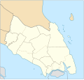
File:Johor location map.svg
Appearance

Size of this PNG preview of this SVG file: 629 × 599 pixels. Other resolutions: 252 × 240 pixels | 504 × 480 pixels | 806 × 768 pixels | 1,075 × 1,024 pixels | 2,150 × 2,048 pixels | 1,035 × 986 pixels.
Original file (SVG file, nominally 1,035 × 986 pixels, file size: 65 KB)
File history
Click on a date/time to view the file as it appeared at that time.
| Date/Time | Thumbnail | Dimensions | User | Comment | |
|---|---|---|---|---|---|
| current | 13:12, 13 January 2018 |  | 1,035 × 986 (65 KB) | Goran tek-en | {{Information |description ={{en|1=A map showing districts and PBT (local authorities) of Johor (blank version)<br> Approximate geographic limits of the map: *N 3.108806 *W 102.365112 *S 1.270019 *E 104.61731}} |date =20180113 |source... |
File usage
No pages on the English Wikinews link to this file. Pages on other Wikimedia projects are not listed here.
Global file usage
The following other wikis use this file:
- Usage on en.wikipedia.org
- Johor Bahru
- Pasir Gudang
- Rawa Island
- Pemanggil Island
- Besar Island, Johor
- Kukup
- Mersing
- Labis
- Senai International Airport
- Iskandar Puteri
- Ayer Hitam
- Yong Peng
- Sultan Abu Bakar State Mosque
- Pasir Pelangi Royal Mosque
- Sultan Ibrahim Jamek Mosque
- Pasir Gudang Jamek Mosque
- Jementah
- Parit Raja
- Bandar Tenggara
- Tampoi, Johor
- Perling
- Bukit Kepong incident
- Air Panas
- Kempas
- Mengkibol
- Tenggaroh
- Sagil
- Sungai Mati
- Parit Bakar
- Semerah
- Sri Medan
- Sungai Balang
- Sultan Ismail Jamek Mosque
- Bandar Baru UDA Jamek Mosque
- Tanjung Kupang
- Gemas Baru
- Tongkang Pechah
- Ungku Tun Aminah Jamek Mosque
- Kolam Ayer Mosque
- Lima Kedai
- Senggarang, Johor
- Sri Gading
- Wikipedia:WikiProject Malaysia/Cartography
- Seelong
- Kangkar Pulai
- Tebrau
- Pulau Merambong
- Taman Sri Lambak
- Muar (town)
- Batu Pahat (town)
View more global usage of this file.
