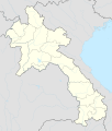
File:Laos adm location map.svg
Appearance

Size of this PNG preview of this SVG file: 510 × 600 pixels. Other resolutions: 204 × 240 pixels | 408 × 480 pixels | 653 × 768 pixels | 870 × 1,024 pixels | 1,741 × 2,048 pixels | 1,961 × 2,307 pixels.
Original file (SVG file, nominally 1,961 × 2,307 pixels, file size: 477 KB)
File history
Click on a date/time to view the file as it appeared at that time.
| Date/Time | Thumbnail | Dimensions | User | Comment | |
|---|---|---|---|---|---|
| current | 16:38, 14 February 2018 |  | 1,961 × 2,307 (477 KB) | NordNordWest | upd |
| 18:36, 1 December 2014 |  | 1,961 × 2,307 (530 KB) | NordNordWest | == {{int:filedesc}} == {{Information |Description= {{de|1=Positionskarte von Laos}} {{en|1=Location map of Laos}} {{Location map series N |stretching=105 |top=22.9 |bottom=13.6 |left=99.7 |right=108.0 }} |Source={{Own using}} * United States National I... |
File usage
No pages on the English Wikinews link to this file. Pages on other Wikimedia projects are not listed here.
Global file usage
The following other wikis use this file:
- Usage on af.wikipedia.org
- Usage on ast.wikipedia.org
- Usage on blk.wikipedia.org
- Usage on bn.wikipedia.org
- Usage on cdo.wikipedia.org
- Usage on de.wikipedia.org
- Luang Prabang
- Vientiane
- Savannakhet
- Pakse
- Attapeu
- Flughafen Vientiane
- Phonsavan
- Sam Neua
- Vieng Xai
- Vang Vieng
- Vorlage:Positionskarte Laos
- Thakhek
- Benutzer:Luisah/Muang Xay
- Phongsali
- Champasak (Stadt)
- Muang Xay
- Militärflugplatz Long Tieng
- Muang Sing
- Boten (Luang Namtha)
- Luang Namtha
- Pakxong
- Pakxan
- Liste der Flughäfen und Flugplätze in Laos
- Veun Kham
- Muang Khong
- Hat Xai Khun
- Nakasong
- Thakho
- Lao-Nippon-Brücke
- Set Tai
- Khinak
- Ban Houayxay
- Neues Nationalstadion von Laos
- Nationalstadion von Laos
- Savannakhet-Provinzialstadion
- Champasak-Stadion
- Muang Kham (Laos)
- Tham Kong Lo
View more global usage of this file.


