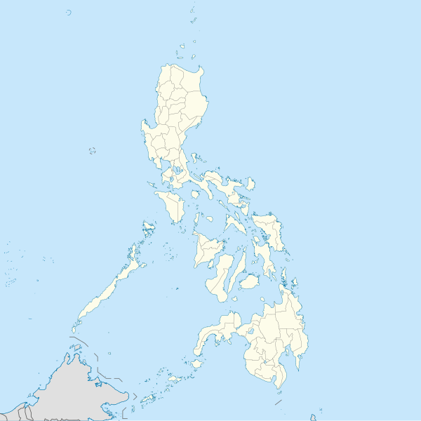
File:Philippines location map (square).svg
Appearance

Size of this PNG preview of this SVG file: 600 × 600 pixels. Other resolutions: 240 × 240 pixels | 480 × 480 pixels | 768 × 768 pixels | 1,024 × 1,024 pixels | 2,048 × 2,048 pixels | 1,332 × 1,332 pixels.
Original file (SVG file, nominally 1,332 × 1,332 pixels, file size: 1.49 MB)
File history
Click on a date/time to view the file as it appeared at that time.
| Date/Time | Thumbnail | Dimensions | User | Comment | |
|---|---|---|---|---|---|
| current | 10:17, 19 August 2021 |  | 1,332 × 1,332 (1.49 MB) | AichiWikiFixer | Updated boundaries |
| 07:53, 18 June 2021 |  | 1,332 × 1,332 (2.24 MB) | AichiWikiFixer | Map update. | |
| 03:55, 18 June 2021 |  | 1,332 × 1,332 (2.23 MB) | AichiWikiFixer | Small changes. | |
| 03:49, 18 June 2021 |  | 1,332 × 1,332 (2.23 MB) | AichiWikiFixer | External changes for boundaries and coastlines. | |
| 13:11, 17 June 2021 |  | 1,332 × 1,332 (2.23 MB) | AichiWikiFixer | Additional islands, lakes, and updated coastlines. | |
| 10:34, 17 June 2021 |  | 1,332 × 1,332 (2.23 MB) | AichiWikiFixer | Update boundaries. | |
| 02:04, 25 May 2021 |  | 1,332 × 1,332 (2.22 MB) | HueMan1 | Reverted to version as of 07:24, 7 September 2020 (UTC) | |
| 07:11, 17 May 2021 |  | 1,332 × 1,332 (3.72 MB) | Petriolo | Reverted to version as of 05:36, 3 May 2021 (UTC) The new administrative borders are based from the Philippine government websites (https://www.geoportal.gov.ph/; http://noah.up.edu.ph/), and is deemed accurate. These new files have reliable sources and there's no "beauty" in it if it is inaccurate in the first place. | |
| 14:00, 16 May 2021 |  | 1,332 × 1,332 (2.22 MB) | AichiWikiFixer | Reverted to version as of 07:24, 7 September 2020 (UTC) (Borders seen as ugly) | |
| 05:36, 3 May 2021 |  | 1,332 × 1,332 (3.72 MB) | Petriolo | updated with NAMRIA borders |
File usage
No pages on the English Wikinews link to this file. Pages on other Wikimedia projects are not listed here.
Global file usage
The following other wikis use this file:
- Usage on af.wikipedia.org
- Usage on ar.wikipedia.org
- Usage on arz.wikipedia.org
- Usage on ast.wikipedia.org
- Asturias (Filipines)
- Toboso
- Lucena (Filipines)
- Alcala
- Manila
- Módulu:Mapa de llocalización/datos/Filipines
- Mar de Joló
- Luzón
- Komisyon sa Wikang Filipino
- Mar de Visayas
- Mindanao
- Lingayén
- Tarlac
- Vigan
- Arrozales en terraces de los cordales de Filipines
- Dávao
- Complexu del Batasang Pambansa
- Ríu Pásig
- Estrechu de Mindoro
- Estrechu de Luzón
- Islles de Calamianes
- Módulu:Mapa de llocalización/datos/Filipines/usu
- Aeropuertu Internacional Ninoy Aquino
- Pasay
- Parañaque
- Universidá de Bulacán
- Aeropuertu Daniel Z. Romuáldez
- Aeropuertu Evelio Javier
- Aeropuertu Francisco B. Reyes
- Aeropuertu Godofredo P. Ramos
- Aeropuertu d'Awang
- Aeropuertu de Bancasi
- Aeropuertu de Dipolog
- Aeropuertu d'Ipil
- Aeropuertu de Joló
- Aeropuertu de Labo
- Aeropuertu de Laguindingán
- Aeropuertu de Lumbia
- Aeropuertu de Naga
- Aeropuertu de Pagadían
View more global usage of this file.
