File:BlankMap-Caribbean.png
Jump to navigation
Jump to search
No higher resolution available.
BlankMap-Caribbean.png (419 × 445 pixels, file size: 10 KB, MIME type: image/png)
| This free media file is from Wikimedia Commons. Its description page is included below. |

|
This locator map image could be re-created using vector graphics as an SVG file. This has several advantages; see Commons:Media for cleanup for more information. If an SVG form of this image is available, please upload it and afterwards replace this template with
{{vector version available|new image name}}.
It is recommended to name the SVG file “BlankMap-Caribbean.svg”—then the template Vector version available (or Vva) does not need the new image name parameter. |
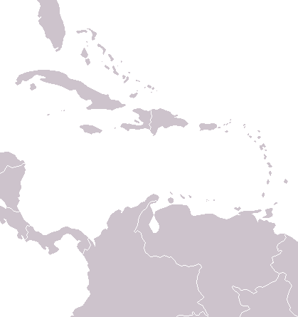
A political map of the Caribbean as of 2004, made by the uploader for Wikipedia.
Vardion, the copyright holder of this work, hereby publishes it under the following license:
| I, the copyright holder of this work, release this work into the public domain. This applies worldwide. In some countries this may not be legally possible; if so: I grant anyone the right to use this work for any purpose, without any conditions, unless such conditions are required by law. |
File history
Click on a date/time to view the file as it appeared at that time.
| Date/Time | Thumbnail | Dimensions | User | Comment | |
|---|---|---|---|---|---|
| current | 05:18, 2 July 2006 | | 419 × 445 (10 KB) | Hoshie | Map has been updated to add a pixel or two for Navassa Island, a US territory W of Haiti. |
| 04:55, 8 December 2004 |  | 419 × 445 (6 KB) | Vardion | a blank map of the Caribbean |
File usage
No pages on the English Wikinews link to this file. Pages on other Wikimedia projects are not listed here.
Global file usage
The following other wikis use this file:
- Usage on am.wikipedia.org
- Usage on fa.wikipedia.org
- Usage on ht.wikipedia.org
- Usage on mk.wikipedia.org
- Usage on pt.wikibooks.org
- Usage on sco.wikipedia.org