File:January 2009 Bay of Biscay storm tracker.png
Jump to navigation
Jump to search
No higher resolution available.
January_2009_Bay_of_Biscay_storm_tracker.png (650 × 500 pixels, file size: 173 KB, MIME type: image/png)
| This free media file is from Wikimedia Commons. Its description page is included below. |
Summary
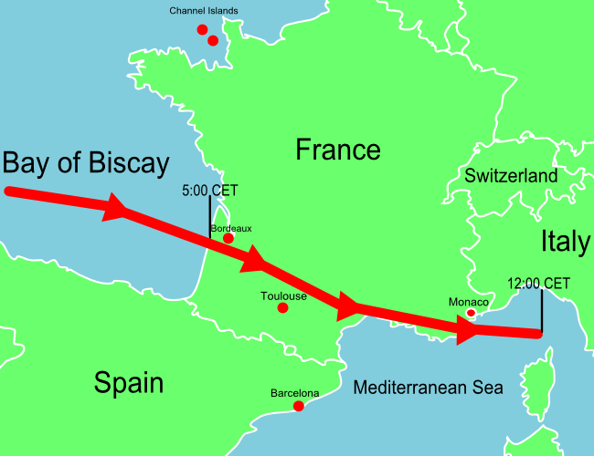
| Description | A map of Europe showing the location of the January 2009 Mediterranean storm. The red line shows the track of the storm. |
| Date | |
| Source | Self-made losely based upon BBC map, but not a derivitive work. |
| Author | Jolly Janner |
| Other versions | The original vector version |
Licensing
| I, the copyright holder of this work, release this work into the public domain. This applies worldwide. In some countries this may not be legally possible; if so: I grant anyone the right to use this work for any purpose, without any conditions, unless such conditions are required by law. |
File history
Click on a date/time to view the file as it appeared at that time.
| Date/Time | Thumbnail | Dimensions | User | Comment | |
|---|---|---|---|---|---|
| current | 14:07, 25 January 2009 | 650 × 500 (173 KB) | Jolly Janner | Added Channel Islands and labeled Switzerland | |
| 01:11, 25 January 2009 | 650 × 500 (163 KB) | Jolly Janner | {{Information |Description=A map of Europe showing the location of the January 2009 Mediterranean storm. The red line shows the track of the storm. |Source=Self-made losely based upon [http://newsimg.bbc.co.u |
File usage
The following 2 pages use this file:
Global file usage
The following other wikis use this file:
- Usage on de.wikinews.org
- Usage on en.wikipedia.org
- Usage on es.wikipedia.org
- Usage on eu.wikipedia.org
- Usage on fr.wikipedia.org
- Usage on pl.wikipedia.org
- Usage on pl.wikinews.org
- Usage on zh.wikipedia.org