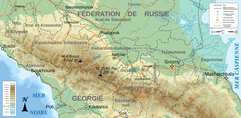
File:North Caucasus topographic map-fr.svg
Appearance

Size of this PNG preview of this SVG file: 800 × 392 pixels. Other resolutions: 320 × 157 pixels | 640 × 313 pixels | 1,024 × 501 pixels | 1,280 × 626 pixels | 2,560 × 1,253 pixels | 805 × 394 pixels.
Original file (SVG file, nominally 805 × 394 pixels, file size: 3.89 MB)
File history
Click on a date/time to view the file as it appeared at that time.
| Date/Time | Thumbnail | Dimensions | User | Comment | |
|---|---|---|---|---|---|
| current | 15:44, 29 June 2024 |  | 805 × 394 (3.89 MB) | Aslan Merzho | Reverted to version as of 09:10, 26 June 2024 (UTC) |
| 17:49, 28 June 2024 |  | 805 × 394 (3.89 MB) | 𝐺ℎ𝑖𝑙𝑔ℎ𝑜 | Reverted to version as of 21:07, 25 June 2024 (UTC) | |
| 09:10, 26 June 2024 |  | 805 × 394 (3.89 MB) | Flandria12 | Актальная карта, вандализм. Reverted to version as of 21:01, 14 June 2024 (UTC) | |
| 21:07, 25 June 2024 |  | 805 × 394 (3.89 MB) | 𝐺ℎ𝑖𝑙𝑔ℎ𝑜 | Reverted to version as of 22:49, 10 June 2024 (UTC) | |
| 21:01, 14 June 2024 |  | 805 × 394 (3.89 MB) | Aslan Merzho | Reverted to version as of 00:13, 15 February 2023 (UTC) | |
| 22:49, 10 June 2024 |  | 805 × 394 (3.89 MB) | 𝐺ℎ𝑖𝑙𝑔ℎ𝑜 | Reverted to version as of 01:44, 1 February 2023 (UTC) | |
| 00:13, 15 February 2023 |  | 805 × 394 (3.89 MB) | Takhirgeran Umar | Reverted to version as of 21:08, 13 January 2020 (UTC) | |
| 01:44, 1 February 2023 |  | 805 × 394 (3.89 MB) | Niyskho | Reverted to version as of 16:42, 8 November 2008 (UTC) | |
| 21:08, 13 January 2020 |  | 805 × 394 (3.89 MB) | Takhirgeran Umar | Clarification | |
| 17:27, 9 November 2008 |  | 805 × 394 (3.89 MB) | Bourrichon |
File usage
The following page uses this file:
Global file usage
The following other wikis use this file:
- Usage on en.wikipedia.org
- Usage on fi.wikipedia.org
- Usage on fr.wikipedia.org
- Usage on incubator.wikimedia.org
- Usage on vi.wikipedia.org


